The recent discovery of the earlier name for Banagher by Kieran Keenaghan & James Scully.
In 1120 Turlough O’Connor, high-king of Ireland, built a ‘principal’ bridge on the River Shannon at a place called Áth Cróich. Recent study has proven that this is an earlier name for Banagher.
SIR MATHEW DE RENZY (1577-1635)
Sir Mathew De Renzy writing in December 1620 about West Offaly with particular reference to roads and passageways made two clear statements regarding a major crossing point on the River Shannon at Banagher and how there was practical and convenient access to the West and Galway from that location.
1. ‘At the Benghar there ought a towne or a good fort to be made, to keep that passage of the Shannon, for that in no other place can come any horsemen near the river to take passage out of Connaught but only here, by reason of the impediments of the bogs and woods; from this passage it is but 30 or 34 miles to Galway all hard and fair ground.
2. At Banagher ‘…to be no more than about 30 miles (from the Shannon at Ahcro or Benghar to) to Galway over the Shannon, all hard and faire ground
Both these references leave no doubt that there was a major crossing point at Banagher in the 1620s. More importantly the second quote equates Banagher with a place called Ahcro (Áth Cróich). This information was crucial to the recent acceptance by the Locus placenames project (Locus) that the two places are synonymous. Consequently, in future editions of their definitive dictionary of Irish placenames, Banagher and Áth Cróich will be recorded as one and the same place. The implication of this decision is that it requires a major revision of Banagher’s early history.
DE RENZY’S LOCAL KNOWLEDGE
At that time of his writings De Renzy had lived in Clonony Castle, near Banagher, in West Offaly, for almost ten years. He had become very knowledgeable of the local landscape. This is evidenced throughout scores his letters and on the twenty or so maps of the locality that he caused to be made. His descriptions of the area are repeated and detailed, and reliable. Such familiarity was essential for his security in a hostile environment and for the promotion of the forthcoming plantation of West Offaly.
Another significant consideration in this decision by the Locus project was that the placename ‘Banagher’, that is Banagher on the Shannon, does not appear in any annals or historic document until 1539, more than 400 years after that of Áth Cróich. In addition, other important historical records dating to 1580, 1601 and 1614 which list crossing points on the mid-Shannon indicate that Banagher and Áth Cróich were one and the same place and werenot listed separately.
The state papers for 1614 which lists crossing points in need of fortification is particularly clear:
Athlone has his majesty’s castle and a bridge which was rebuilt by Sir Henry Sydney. The next to that of importance is Aghacroghe upon McCoghlan’s country which lies open and is noisome to that part of the province. There are two more at Meelick and Portumna. The rest though they be at some times passable, yet are less used, and nothing so hurtful to the province.
REVISED HISTORY
Now that Banagher and Áth Cróich are accepted as synonymous, earlier historic events can be associated with the town and the early history of Banagher can be rewritten. For example, the bridge built at Áth Cróich in 1120 by Turlough O’Connor, one of the greatest high-kings of Ireland, may have been an earlier phase of a medieval bridge at Banagher. In 1168 Turlough’s son Rory, the last high king of Ireland gathered his forces at Áth Cróichand in 1266 Mac William Burke assembled an army there. The Anglo-Norman inquisition of 1333 refers to a weir held by a tenant at Áth Cróich.
Why then has this connection between Áth Cróich and Banagher been overlooked for so long? Most likely this is because of the absence of Banagher from sources before 1539. This was also compounded by the misplacing of Áth Cróich at Shannon Harbour by the great scholar John O’ Donovan when writing in 1838. A basic reading of the landscape at Shannon Harbour shows that it was not the location for the ancient crossing point on the Shannon which had ‘all hard and faire ground’ between it and the city of Galway. Since O’Donovan, antiquarians and historians without exception have repeated this mistake.
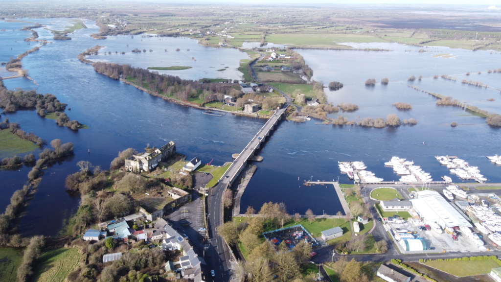
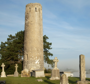
Flooding occurs frequently on the mid-Shannon and this image (looking westward) shows the Shannon at Banagher in a typically flooded state. Between Meelick and Athlone, Banagher is exceptional in that there is year-round access to the river thanks to the esker at the crossing point.
MEDIEVAL BRIDGE AT BANAGHER
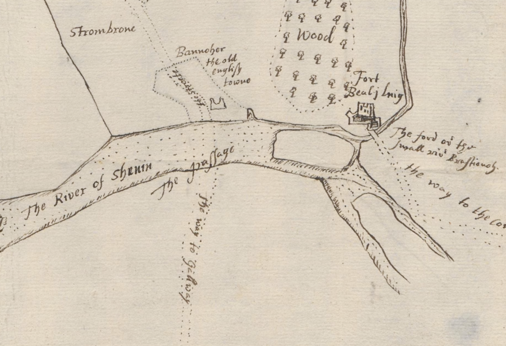
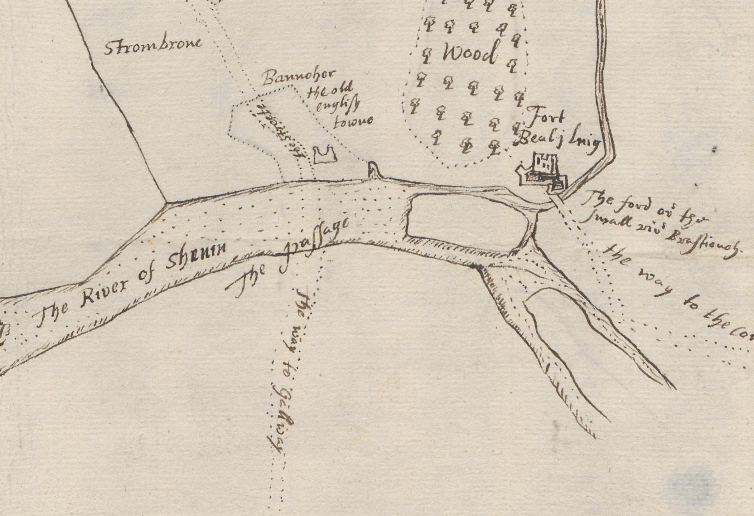
This extract from a 1620s map by surveyor John Gwin who laid out the Corporation town shows the location of ‘The Passage’ and ‘the way to Galway’ from Banagher .
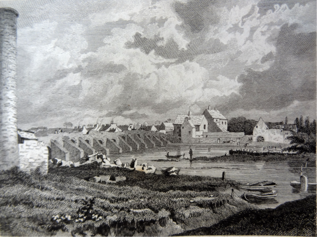
Old Banagher Bridge as it was drawn in 1820 by George Petrie showing its typical medieval characteristics.
Evidence for an early medieval bridge at Banagher is more dependent on nineteenth-century documents than earlier sources. The earliest date for a bridge at Banagher is from Pigot’s Directory of 1824 which alludes to a bridge built by Roderick O’ Conor, King of Connaught, in 1049. Burke’s Peerage of c.1860 in speaking of Thomas Armstrong (1639-89) states ‘….in his time a new stone bridge over the River Shannon was commenced…’
The Civil Engineer and Architect’s Journal for 1841 suggests a very early date for the construction of the bridge, as follows: ‘It may however be considered from it having been built in the reign of King John if not the oldest bridge over the Shannon as at all events possessing an age which few other bridges can so satisfactorily trace and is on that account a very highly interesting work of antiquity. In its construction we find all that characterizes the early specimens of bridge architecture; the small arches for allowing the passage of water and unnecessarily wide piers.’
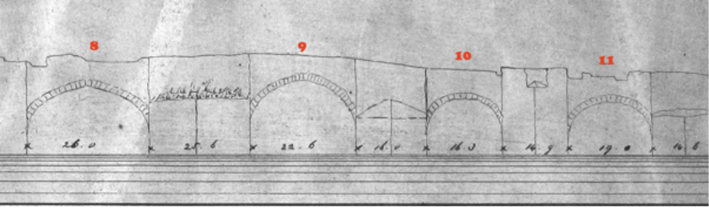
Detailed drawings of this bridge as it survived until it was demolished on the 14th August 1843, two days after the present bridge was opened, are also extant. These drawings by Henry Renton, details the span of the arches, and width of the piers which also indicate an early medieval date.
Old Banagher Bridge as it was drawn in 1820 by George Petrie showing its typical medieval characteristics.
TAIRDELBACH UA CONCHOBAIR (Turlough O’ Connor ) (1088-1156)
The following extract from the Dictionary of Irish Biography gives us some idea of Turlough O’Connor’s immense importance in the twelfth century:
His accession to the kingship of Connacht in 1106, and his domination of that province for the next half-century, saw the emergence of Connacht as a major political power for the first time since the seventh century. Tairdelbach demonstrated a truly remarkable energy and enterprise, and of all the Irish kings he was the most effective military commander and the most innovative strategist and tactician. Others before him had utilised fortifications to a degree; Tairdelbach constructed an entire system of earthwork defences and castles to provide a frontier defence for Connacht.
In addition, as referred to above, he built three ‘principal’ bridges in Áth Luain, (Athlone), Dún Ló (Ballinasloe) and Áth Cróich (Banagher). The annals make several references to the presence of Turlough’s forces on the Shannon at Meelick and in particular record that in 1115 he built his first fortification at Incherky, in Lusmagh, just south of Banagher, making use of a great fleet on the River Shannon in doing so. His descendant, Felidhm was imprisoned for almost a year in Meelick Castle by the De Burgos in 1230.
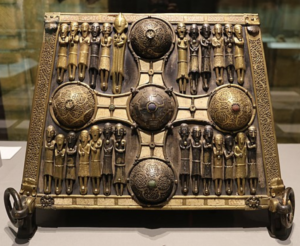
Turlough O’Connor also built the great round tower at Clonmacnoise and he was also patron of the magnificent Saint Manchan’s Shrine both within a matter of a few years of his bridge at Áth Cróich or Banagher.